LONG TRAIL – 14 August - 07 September 2015

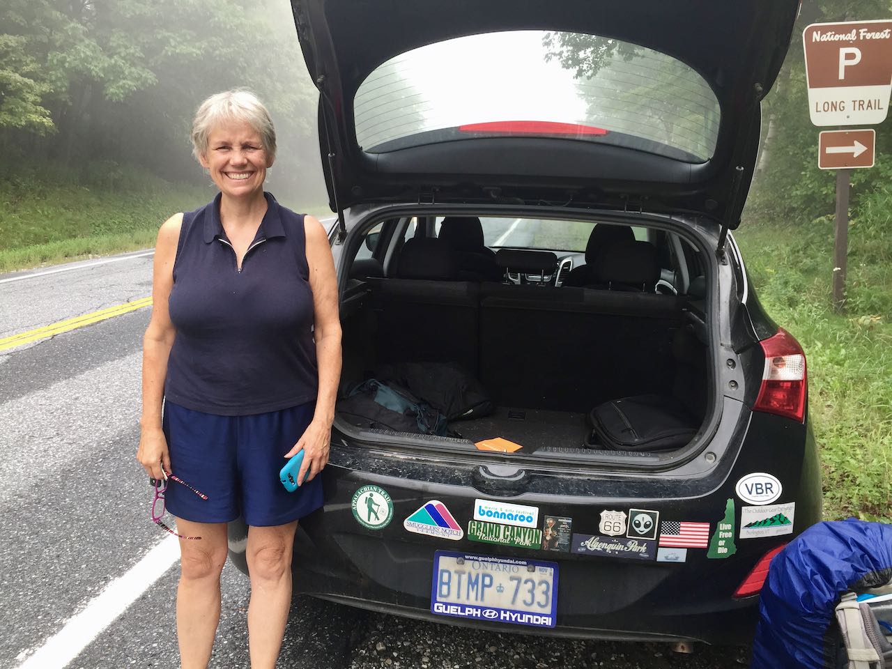
Aug 14: My buddy Dave Doyon gave me a ride to North Adams, MA after work on Friday. He was most helpful by driving me to GA and then meeting me a couple times in MA and NH to exchange some gear when I did the AT. I dub thee “Pancho Villa” for a trail name.
I rented an overpriced room at the Holiday Inn for the night. On the way into North Adams there were thunderstorms for the evening with a lot of rain – I was concerned the trip would start out very wet. But, watching the news during dinner, they said VT would be having a heat wave with temps in the high 80’s to low 90’s and very humid. They were correct! Although temps were a few degrees cooler in the woods and at higher altitudes, it was very hot & humid the first week.
On a unplanned coincidence, two years ago when I was hiking the AT, I started in North Adams, MA on August 15th. I happened to start on the same date this year for my LT hike. The first 100+ miles of the Long Trail and the AT are the same until you reach Mount Killington, VT. There the AT takes a sharp turn east towards Hanover, NH while the Long Trail continues straight north through VT to the Canadian border. Just for laughs, I have included my mileage to compare my AT hike with the LT hike I did this year.
| AT – Aug 2013 | LT – Aug 2015 | |
| 15-Aug | 14.1 | 14.0 |
| 16-Aug | 18.7 | 14.4 |
| 17-Aug | 22.9 | 11.6 |
| 18-Aug | 12.9 | 12.6 |
| 19-Aug | 19.6 | 8.8 |
| 20-Aug | 20.1 | 13.5 |
| 21-Aug | 1.0 | 16.9 |
| 22-Aug | 17.4 | |
| Miles | 109.3 | 109.2 |
To reach the same spot at Route 4 near Killington, it took me two extra days compared to when I did the AT.

Aug 15, 14 miles: “Pancho Villa” (Dave) dropped me off at the trailhead in North Adams, MA which is about 3-4 miles short of the VT border. I started hiking and ended up at the Congdon shelter the night. It was a hot day and I was soaked with sweat by the time the day was over. It was a long day and the last two hours seemed to take forever to reach the shelter. Nighttime temps the first week were in the high 70’s, maybe even the low 80’s. It was very warm.
Aug 16, 14.4 miles: This was another long day due to the heat and my lack of hiking long distances for a number of months. I stayed at the Goddard shelter. The first 3-4 days of hiking I suffered the last 2-3 hours each day – I kept thinking “the shelter must be just up ahead” or some such nonsense…my sense of distance, hiking speed, etc. were way off!
Aug 17, 11.6 miles: This day started out poorly as I hiked up from the shelter approximately 0.5 miles to the top of the hill and started down the other side before I realized I had the wrong shirt on and I left my hiking shirt at the last shelter. What a pain. I hiked back up to the top, dropped my pack and went back to the shelter to change shirts. The rest of the day was OK, partly cloudy and warm. I stealth camped with another guy at Black Brook near the footbridge for the night.
Aug 18, 12.6 miles: Another warm day of hiking. At the top of Stratton Mountain, there is a lookout tower and there were some great views with minor clouds off the peak. Stratton Mountain is where Benton MacKaye conceived of the idea for the AT. I did get to hike near Stratton Pond and contemplated jumping in to cool off but decided to keep hiking.
Aug 19, 8.8 miles: This was a short day as I stopped into Manchester Center, VT to resupply and buy some gear. I spent 4 or so hours there and had a burger on my way out of town. I have been absolutely soaked the past few days and some of my gear in the pack was wet every night when I stopped. I assumed this was because the weather was so hot and my water bladder was sweating due to the humidity. I almost purchased new water bladder at the gear store and was holding it in my hand but declined at the last minute. This was a mistake as we will see later! I hiked out 3 miles to the summit of Bromley Mountain. This is a ski mountain and they let hikers use the Ski Patrol hut at the summit. I arrived at the peak around 4:30pm and the weather was great. Nice temperatures with a good breeze. I took apart a lot of my gear and changed clothes so I could lay everything out to dry off. I decided to stay in the hut for the night and 3 other hikers rolled in also.


Aug 20, 13.5 miles: Woke up to a cloudy, misty morning on top of Bromley. This was a great day of hiking…somewhat cooler and I just made the Big Branch Shelter before some rain moved in. Honeybee and I thought we might have the shelter to ourselves but then 7-8 AT hikers rolled in and another 4-5 LT hikers! It was a busy night at the shelter but the river was just in front of us and you could rinse some clothes out and wash a bit which was nice.
Aug 21, 16.9 miles: It rained overnight and a little in the morning but it turned into a sunny day later. I made some good miles and ended up at the Clarendon Shelter for the night.


Aug 22, 17.4 miles: My original plan was to hike to a shelter just short of Route 4 near Killington Mountain, spend the night, and then do a short hike to route 4 and go to Rutland, VT for the day and night to resupply and relax. I made it over Killington fine and actually went to the Pico Camp shelter which is 0.5 miles off the trail. However, once I was there, I decided it was only 2.9 miles more to Route 4. So, I hiked 0.5 miles back onto the LT and went down to Route 4. I started thumbing around 6pm and a shuttle bus stopped and picked me up. For $2 they took me the 8-10 miles straight into Rutland, VT and I stayed at the Yellow Deli Hostel for the night. This was a great place, very relaxing and I had a whole room for 10-12 people to myself since it was not very busy.
Aug 23, 5 miles: I slept in and then got up to resupply in Rutland. The hostel had some leftover hiker breakfast they gave to me. It was an excellent rice and egg mixture. I then walked a couple hundred yards to the Walmart and stocked up on a few days worth of food. Around 2pm I took the bus back to Route 4 where the LT and AT cross over. I hiked 5 miles to the Rolston Rest shelter for the night. It was warm but not as bad as the week before. Comfortable hiking to the shelter.

Aug 24, 13.7 miles: It was a cooler day but there was some tougher hiking up and down slabs and around a lot of roots. I stayed at the Sunrise shelter with a retired Air Force dentist and a former city planner from the Scottsdale, AZ area. I was absolutely soaked again as I had been since I started on the 15th. My gear was still wet in the pack and I was concerned what would happen when the temperatures dropped and I was not able to dry stuff out each night. We performed an experiment that night and hung up my water bladder. In the morning, it was down a liter as there was a very small leak. What I thought was just sweat from hiking and the bladder sweating naturally from the hot and humid weather was not the case.
This was a huge pain so I decided I would get off the trail tomorrow and get back to Rutland, VT to a gear shop and replace it. This was especially aggravating as I had the exact replacement piece in my hand a week before and contemplated buying it!
Aug 25, 5.4 miles: I got up and hiked a mile to the next road crossing on route 73. I was out to the road by 7:20am and started thumbing…the only problem was only maybe 10 cars went the direction I needed to go in 35 or so minutes. I decided that this road was really poor for thumbing and figured I would just live with the wet gear for the rest of the trip. I was in the process of changing back into my hiking shirt when a pickup truck came up the road. I threw out my thumb for laughs and it stopped! I got a ride 10-12 miles into Brandon, VT. Once there, I hitched again and after 15-20 minutes a truck driver gave me a ride about 20 miles back in to Rutland, VT and dropped me off 100 yards from the hostel I had stayed at a few days before.
I decided to have breakfast at the hostel and was talking to some AT hikers trying to figure how I would get the 6-7 miles to the EMS store and then back 30+ miles to the trailhead to hike. I thought I might get a taxi and then thumb back to the trail and figured I would lose most of the day to get all this done. A woman at the next table overheard me and said she would give me a ride to the store AND back to the trailhead! My savior…known as Hot Tea because she drinks so much tea. She had two sons on the AT this summer…one was finished and the other was still hiking. She was slowly working her way back to northern VT and Canada. Incredible trail magic. I got the gear I needed and was back hiking by 11:30am so I only lost half a day of hiking.


This was a busy shelter with Honeybee, 3 Cups, his dog Mason, Solman and his girlfriend Lark all there.
Aug 26, 11.4 miles: This was a cooler day which was nice although some trail maintenance was needed in some areas due to branches constantly getting in the way. Went over the Middlebury Snow Bowl ski area which had some nice views and also climbed the Broadloaf Mountain peak which is on my New England Highest 100 list. Stayed at the Emily Proctor shelter.
Aug 27, 11.7 miles: Hiked to the Battell Shelter. went over Mount Wilson early which is also on my New England Highest 100 list. It was a nice day to hike…not too cold or warm.


Aug 28, 10.5 miles: I hiked to the Appalachian Gap and went into the town of Waitsfield, VT to resupply and hopefully do some laundry. I saw some kids at the parking lot and asked which way to the town and they offered to take me down there since they were going there anyway. I resupplied for a couple days of hiking since I had sent myself 7 days of food to Jonesville, VT which I would pick up in a couple days. I stayed at a B&B and the owner was nice enough to do a load of laundry for me! I walked down to a farm that had organic flatbread pizza which was excellent. They did not have small pizzas on the menu but she said they would make me one. Then she called me over and said they messed up another order for the same pizza and instead of throwing it away, they gave me a large for no extra cost! I did not realize it but Solman, his girlfriend Lark and his buddy Moose were there. I had not seen them in a couple days and did not even realize they were in town.
The two photos above were on top of Mount Abraham early in the morning before the weather cleared.


This is the Starks Nest at the top of the Mad River Glenn ski area. They had a rain bucket for hikers to get water from. This was very nice as the further north we went, the less water was on the trail. In a lot of cases, the only water was at the shelters and some of that was pretty poor.

Moose, Solman and Lark at the American Flatbread pizza at Lareau Farm farm in Waitsfield, VT.

Aug 29, 10.6 miles: Hiked to the Montclair Glenn shelter. There were warnings that there were some bear issues in this area and especially at the shelter. It was a great day to hike with some nice temps. The day started out cloudy but was nice and sunny most of the day. The climb up and down Burnt Rock mountain was tough. You can see a picture of “Ladder Ravine” further below. There were a number of ladders along what whole trail that are needed on some steep sections. The Monclair Glenn shelter had a caretaker and was $5/night. Because of the bear issues they had recently added a “bear box” to store all food, toothpaste, etc. in at night. They kept the door secured during the day and asked that you keep it closed unless someone was inside or around the immediate outside area.
Aug 30, 8-11.5 miles: The day started out with a tough climb over Camel’s Hump mountain. This is a bald peak with a lot of scrambling on the rocks to get to the top. The exact distance hiked is difficult to determine since there is a 3+ mile hike along a road to the Post Office in Jonesville, VT. When I planned this hike, I figured this was a good spot to mail myself some extra food and meals since the trail went right by the post office. But, this became the “Debacle in Jonesville” as I will explain…
Problem #1 – I neglected to check the Green Mountain Club (GMC) website and found out later that the trail no longer went right by the post office. They had build a new suspension bridge for the hikers over the Winooski River and it cut off a couple miles of boring hiking along roads. The first 1-1.5 miles were still along a road which was not really fun hiking, then, the trail started into farmers fields until the suspension bridge. Once you cross that, the trail crosses Route 2 and continues north. However, I had to get a couple miles West to the post office to get my mail. So, the first problem was extra mileage that I did not have to travel.
Problem #2 – When I mailed myself the box, I thought the odds were pretty good that I would get into this town sometime Monday – Saturday. Of course I came in on a Sunday when the post office is not even open. So I thumbed into the town of Richmond and had a late lunch and hung out. I then thumbed back to Jonesville to find a place to camp for the night. After an hour or so, I was not having much luck so I started thumbing towards Richmond and a guy ended up taking me 12+ miles to Willitson, VT where I stayed at a Fairfield Inn for the night. I did manage to do some laundry in the sink and dry out my gear.


Aug 31, 7.3 miles: After a night at the Fairfield Inn, I got up and walked a couple miles to a major crossroad so I could thumb 12+ miles back to the post office in Jonesville. My goal was to get there at 8am and I was very close to that.
Problem #3 – If you go to the official USPS web site it states that the hours are 8-12:30pm and 1:30 – 5pm, Mon – Fri. However, when I showed up at the post office, the service window opens at 12:45pm Mon – Fri!!!! So, I had to hang out almost 5 hours to wait for my box. What a pain. Luckily a couple of south-bound hikers came in also and we chatted for the morning.
All-in-all, I lost 3-4 hours of hiking on the previous afternoon and another 6 or so hours of hiking today.
Once I got my box and sorted out my pack with the additional food, I hiked 7.3 miles to the Buchanan shelter for the night. The hike was very warm and slow since I had 7+ days of food in my pack.
Sep 1, 10.6 miles: Another warm and sunny day hiking to Butler shelter for the night. My left achilles was bothering me and there was some tough hiking so it was not a day for big mileage.
In one of the pictures below,. you can just see the top of a ladder between two trees. This is another short, steep ladder climb down.
Sep 2, 12.1 miles to Whiteface shelter. The climb up Mt. Mansfield was short but steep. Lots of rock scrambling and tough areas. The weather up top was cloudy and cool early in the morning. The rest of the day was nicer and warm again.
Although the picture below makes it look harmless, under this wooden bridge there is a straight drop down 50+ feet with a bunch of trees and brush growing there.
The last photo is looking almost straight down. You can see a couple white blazes marking the trail in the middle of the photo and then on the right side of the rocks heading down. There were a number of very steep sections going down and it was a good thing it was not rainy or wet. In any case, these are areas where you just have to slow down and be careful.
Sep 3, 10.4 miles: Another mild day – it was cloudy but warm and humid. A couple sprinkles in the morning but when I say a couple, I mean you could see a couple wet spots in the rocks and that was it. We had some dirt road walking for a while which was a nice change from the steep up and down. I could let my legs stretch out and relax without paying strict attention to every step. I was rolling along with Passion Flower and Zippy who I had met the night before. We stayed at the Roundtop shelter which I really liked – it had skylights which helped bring in the natural light. We had a nice fire that evening too.
Sep 4, 8.1 miles: Great weather for hiking today. Sunny and comfortable. Great views from Laraway Lookout which was near the top of Laraway Mountain. At the top I heard a lot of barking. I assumed from dogs at first and wondered if the trail was near some houses. Then my imagination started getting the better of me and I thought it was a pack of wild coyotes. But, coyotes weren't real big in the northeast to my knowledge so I didn’t know what to think. I hiked on until the barking receded. Later at the Corliss Camp shelter, I met other hikers who saw a couple hunters and they were their dogs that were making all the racket. It seems they were doing some illegal hunting with their dogs.

Sep 5, 14.5 miles: The only notes I have for this day state “tough day”. Made it to Tillotson Camp for the night. It was a sunny and hot day. Getting through Devil’s Gulch and then the climb after was painful. Everyone that rolled into camp was beat.
A great day for hiking…nice weather.

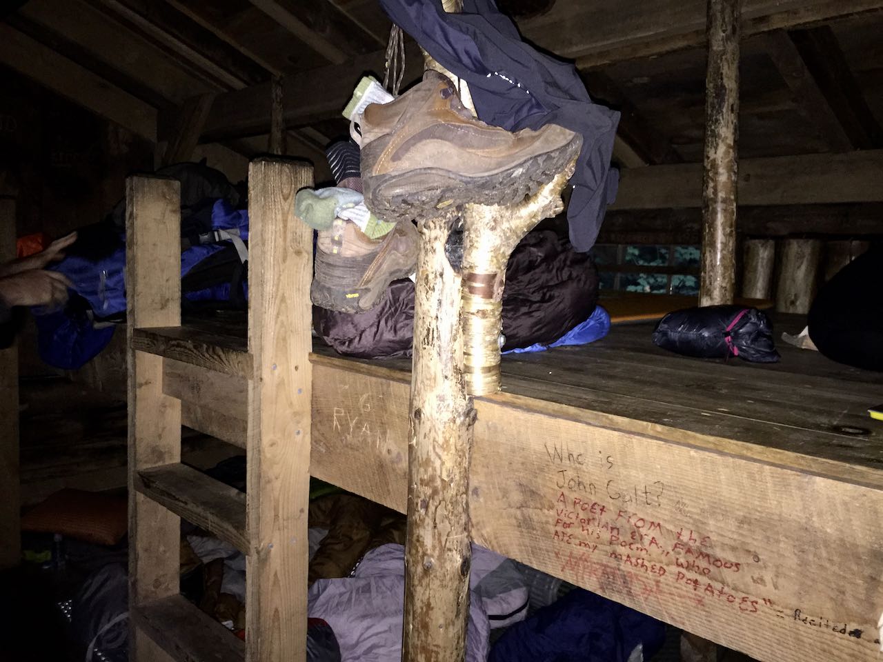
Top left bunk was my spot.


Sep 6, 11.2 miles: Another tough day…very hot. I was running on fumes at the Hazen’s Notch Camp (about 6 miles into the hike) and had to cook up some Raman noodles and hydrate a bunch before moving on. It was a steep climb down Haystack Mountain and then up from Hazen’s Notch to the camp. Brooke and Murphy rolled in after me and were beat also. After an hour to rest and eat, the hike to Jay Camp was not as bad.
We had been hearing rumors that the Cafe on the top of Jay Peak Ski resort was going to be open the next morning at 10am. We are all very excited to get some good food!!!
Jay Camp for the night of Sep 6th.


Sep 7th, 11.9 miles to the border and another 1.3 miles to the parking lot: The day started out cool which was a good thing since we had to gain around 1,500+ feet in 1.7 miles. The climb was smooth though and I was up top around 9:00am. The peak was cool, windy and cloudy for the most part. There was a small entryway in the cafe that was open to hikers and I decided to relax in there for a while until Brooke and Murphy made it up. Once we were together, we tried to figure out if the cafe was going to open or not. Murphy called the resort and they said it would not be open until 11am. We were all frustrated since we did not want to wait another 1-2 hours when we could be hiking on our last day on the trail. But, we decided to relax for a bit and I went outside to explore and noticed that the lift had arrived with some workers. They were nice enough to let us in the cafe around 10:00am so we could charge our phones, use the restrooms and relax. I think they actually worked hard to open the cafe early for the hikers as we decided to wait and they started serving food around 10:30am. We were VERY happy!


The rest of the day was fairly long since it got warm again and we had heard there was no water except at the Shooting Star shelter which was about 4 miles before the Canadian border. By the time I made it to that shelter, I only had a half liter of water left. Unfortunately, the water source was a pump that was broken. When you pumped you had to use your other hand to hold the top on, once the water started coming out, I tried to put my water bottle under it while pumping with the other hand but every time I took my hand off the top, it popped off and the water pressure died. So, I said the heck with it and decided to gut it out.
The rest of the hike looked easier but actually it got very warm and there were some tough up and down sections. I was getting pretty parched when I reached route 105 which is the last road the trail crosses before the end. Brooke was ahead of me somewhere and I was kind of relying on hitching a ride when her father and brother picked her up at the end. Otherwise, I was planning on staying at the Journey’s End Camp and hitching somewhere the next day.
At the road crossing, it was not clear where the trail went so I took my pack off and checked my guide book. While doing this, I noticed there was some construction work going on and a big tractor in the parking lot. I happened to see a box and a couple bottles lying on the ground around it and I had a quick flash that this might be some trail magic! However, when I got closer, the pepsi bottle was half full and it was a box of trash. BUT, there was a full gatorade bottle lying on it’s side in the dirt. With some trepidation, I picked it up and the seal seemed to be intact – so I made a gut decision to take it as I was really dehydrated and was worried about catching up to Brooke with only a few sips of water left and at least another two hours of hiking to go.
The Gatorade was a huge help for the last few miles. I made it to the border around 6pm and took a few quick photos before hiking out the next half mile to the shelter. Brooke heard me coming and yelled that we had to get going. She had written a note to Murphy and me saying she had to move on and “good luck”. But, I just made it and we hiked the last .7 miles to the parking lot. Her father and brother were very nice to let me hitch along. We went a couple hours towards Burlington, VT and they dumped me at a nice hotel called The Essex. I was able to get some laundry done and had dinner and a celebratory beer in their Tavern.
The next day, I set up a 4pm bus from Burlington, VT to Boston, MA. At 9pm, I took another bus north to Newburyport, MA and then a taxi home to Hampton, NH. I was home around 11pm.