Pacific Crest Trail (PCT)
Week 1: 17 – 30 April 2016


April 16, 2016 - I flew into Palm Springs and my buddy B-squared (Bob) picked me up. We walked around Palm Springs and had lunch before heading north to Palm Desert where he lives.
April 17, 2016, 6.4 miles: Bob drove me to the town of Idyllwild where I started hiking the PCT around 10:30am. I started at the Humber Park Trailhead (altitude 6,479 feet) with an immediate increase to almost 9,000 feet and then dropping down to 8,094 feet to camp for the night. The number one issue with the PCT, especially down in southern CA, is that water is very scarce. Consequently, I had loaded up with water at the start of the hike but ended up dumping some of it after an hour of hiking.
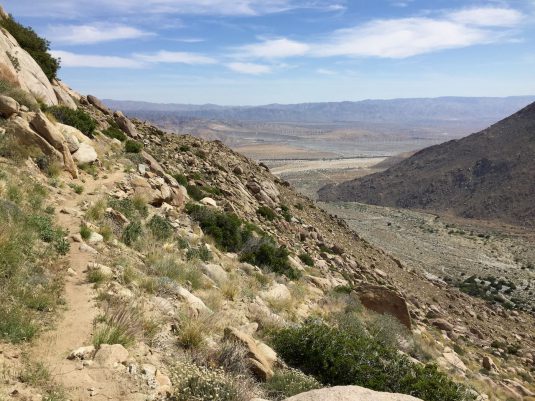


April 18, 2016, 10.3 miles: Today started with a 1,000 foot climb over 2-3 miles and then a somewhat gradual drop down to 6,461 feet where I camped next to the trail in a nice spot. Early in the morning there were a number of spots with snow although they were usually short and fairly easy to negotiate without crampons. I filled up with some water at the last good source we were aware of but that was still going to leave around 20 miles before the next water with a night out camping before I got to it.
April 19, 2016, 12.1 miles: Today started with a long drop to around 1,750 feet in elevation to a water faucet. We lost almost 6,000 feet in elevation. After an hour or two of hiking I was out of the woods and exposed to the sun all day. The weather was very hot but due to the lack of humidity, it is actually tolerable. However, I was forced to conserve water and never did drink as much as I wanted. The vast majority of the trail was completely exposed with very few shady spots. Near the very bottom, there is a water faucet that everyone was happy to see. I had only a couple sips of water left and pretty much everybody that came into this spot was on fumes and out of water.
After relaxing and filling up on water for an hour, I started hiking down another 500+ feet with Spreadsheet and Mulch who I had run into off and on all day. At the road at the bottom of the hill we debated if we wanted to go to the trail angels house or get to a motel. We opted for the motel and after trying to work a ride with Uber, we started hiking down the road to a highway. There was a small neighborhood but almost no traffic to speak of. Spreadsheet did throw out his thumb and a woman named Kendra stopped and told us she would give us a ride into Palm Springs. It was a small car, she had laundry and a dog, and the three of us with our packs on our laps. But, what an angel she was for giving us a ride. To top it off, she said she would pick us up the next morning at 11am and take us to wherever we wanted to get on the trail!!!


April 21, 12.3 miles: I hiked about 1.5 miles to route 18 and thumbed into town around 7:30am. I stopped at Mountain Munchies for breakfast . The staff was SUPER nice. 6-7 people were sitting near me and started asking me questions about hiking. An hour later an older and younger guy who were asking me questions left. When I asked for my bill later, they said those two guys had paid for my breakfast! Incredible. I got a ride back to the trail from Gabriel who used to be a “Hot Shot” which is one level below a “Smoke Jumper”. That night I cowboy-camped at 7,716 feet with an older couple, Instigator and Expeditor. They were very experienced hikers and I ran into them a number of times over the next week.


April 22, 15.8 miles: Cowboy Camped at 5,384 feet with Clint and Jasmine. A lot of the terrain today was hiking through a previous burned area.
In the picture with the rattlesnake, the trail drops off 200-300 feet so we all had to go higher up the hill and try to get by the snake. It was rattling the whole time while we went by him.
April 23, 21 miles: This was a long day. First one over 20 miles. There were some natural Hot Springs and since it was a Saturday, there were a LOT of people there. Probably 200-300. Apparently a lot of the locals can hike in from a road nearby. However, the guide books state it pretty clearly, since it is a clothing optional area, don’t dunk your head or drink from the hot springs or water in this area. So, I did not bother stopping since it was so crowded. In addition, it was a very hot day and much of the trail was exposed so it was a long day. We camped below the Mojave River Forks Dam. However, there was almost no water on either side of the dam so we could not figure out why it was there at all!
April 24, 2016, 15 miles: Camped at Mesa Campground around 3,500 feet.
April 25, 2016, 13.5 miles: Hiked into Cajon Pass and the big draw here was the McDonald’s half a mile off the trail. I was not particularly pumped for it but everyone else hiking had been on the trail for a couple weeks more than me and they are all psyched to eat there. I debated hiking on but decided since it was only 12:30pm and my birthday, why not… In addition, there was a long stretch, 22-27 miles without water coming up and a climb to over 8,000 feet. After an hour or so of eating, I finally decided to stay the night at the Best Western and walked a mile to do laundry, resupply at the gas station and relax.
April 26, 2016, 19.8 miles: This was a long day. The trail was very mellow but after a couple hours up and then down into a valley again, it was a gradual climb up 5,000+ feet over 15 miles. Again, warm and exposed to the sun and heat. Everyone I camped with was pretty beat at the end.
April 27, 2016, 7.6 miles: A short day of hiking to the highway were I hitched into the town of Wrightwood at 5,900 feet. Met some other hikers and resupplied, found a reasonably cheap motel and did laundry.
April 28, 14.6 miles: Got a ride back to the trailhead and was hiking by 8:30am. Spent a couple hours with some minor ups and downs before heading up Baden-Powell peak to 9,300 feet. It was a chilly morning but sun came out and it was nice hiking weather. The climb up Baden-Powell was not too bad although there was snow sections higher up and the last few hundred feet everyone seemed to lose the trail and just bushwhack straight up the snow. This was OK but if you slipped, you were going to possibly fall 200-300 hundred feet before you hit some trees or rocks.
I did not have any crampons but the snow was not that bad as long as you took your time. The summit area was pretty skinny with drops hundreds of feet off each side. Had some nice views and a good break before heading down to camp at 7,488 feet.


Apr 29, 2016, 16.7 miles: This was a long day without much water. I stayed at Camp Glenwood with a bunch of other hikers but the next water source was not for another 6 miles. I really haven’t carried enough water the past couple of days but had enough for dinner and 3/4 of a quart left over for the next morning.
Apr 30, 2016, 18 miles: This was a long day with a 2,000 foot climb in the middle of it. Luckily the morning was nice and cool and mostly downhill. In two hours I managed to go 6 miles to the water source. I didn’t really drink much since it was so cool. I grabbed 3 liters of water for the climb and the rest of the day. It was cool and breezy all day but I finished my water an hour before I finished hiking and was I conserving most of the day. I should have taken another liter.


I camped at the the Mill Creek Fire Station rest area with a bunch of other hikers. There was a water faucet up the hill and the guide book said to treat the water which I did. However, sometime early in the morning I used the rest room and then proceeded to spend much of the day hanging out and using it every 20 minutes. I am assuming I either did not treat the water long enough or with enough chemicals. As you can see from the picture below, I picked a good camping spot for having bathroom emergencies…
During much of my hike I had issues with my left foot. I have had Plantar Fasciitis in my left foot since last summer and knew it was a risk for the hike. I also had it last year when I did the Long Trail in VT but I essentially ignored it on that hike as much as possible. However, on the PCT, I was starting to compensate on my steps…perfectly good with my right foot, heel-to-toe, and then a lot with my left foot I would flat-foot it when it got too sore.
Ultimately, my gait was completely off and my left knee started bothering me and then the achilles heal. I was contemplating getting off the trail for a few days – unlike the Long Trail which was 3 weeks long, the PCT was going to be a
Compounding the problems is I was about to go into a 17 or 27 miles section with NO water. Given that I was already dehydrated from having the runs and not being able to keep much water or food down, I could not see attempting this section. Later in the afternoon I decided I would have to get off the trail and get my foot healed before I hiked further.
So a couple women were nice enough to drive me 30-40 minutes further north to Hiker Heaven in the town of Agua Dulce, CA. This is a house that a couple open up to hikers for 2-3 months every year. It is amazing. They provide camping spots, a few bedrooms, showers, porte-potties, they do your laundry, and have an extensive mail system in their garage. They are extremely nice and helpful and provide shuttle services pretty much any time into town. The pictures below give you a rough idea of their setup. During the busy season, there are probably 25+ hikers here every day.
I ended up staying here for 3 nights while I tried to figure out what I wanted to do. My “stomach issues” got slowly better with the foot issues, I decided to definitely get off the trail. It’s unfortunate but injuries are part of it so I will have to look at doing the PCT another time.


General Impressions of the PCT:
The PCT is much milder to hike than the AT. The PCT is made for horses also so there are minimal steep areas. The AT had a lot of very steep sections, steep enough that require hands and in some cases ladders to get up or down.
The other major difference is the lack of water in Southern CA and the desert environment. Much of the AT is deep in the woods and water is pretty regular every few miles. A long stretch without water on the AT might be 8-10 miles. On the PCT there are a number of sections with 20+ miles lacking water. Although there are trees on the PCT, especially at the higher elevations, much of the trail is constantly exposed to the sun.
Anyway, I enjoyed the hiking I did and look forward to doing something else this summer while my foot heals.